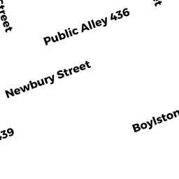
230 NEWBURY ST
Owner Information
TWO 22-232 NEWBURY ST LLC
137 NEWBURY ST #
BOSTON, MA 02116


Property Details
230 NEWBURY ST is classified as a Mixed Use (Primarily Commercial, some Residential) (Apt 4-6 units).
The primary structure on this property was built in 1899. There are 7,240ft2 of built area within this property. There is 6,668ft2 of residential/living space within this property.
230 NEWBURY ST is valued at $5,437,300. The land is valued at $3,576,100 and the structures are valued at $1,860,500. There is an additional valuation of $700 on this property.
The most recent deed for 230 NEWBURY ST is recorded at the local registrar in Book 41108, Page 232. 230 NEWBURY ST was last sold on Wednesday, January 10, 2007 for $9.
Assessment data from fiscal year 2020.
Flood Data
According to the FEMA National Flood Hazard Layer, this property does not appear to be in a flood zone. It may also be in an area not yet reviewed. Nonetheless, confirm this information prior to taking any action.
To view the flood hazards around this property, create a FEMA "Firmette" Map of the area around 230 NEWBURY ST.
Broadband Internet Providers
| Provider | Type | Bandwidth (mbps) | |
|---|---|---|---|
| VSAT Systems, LLC. | Satellite | 2 | 1 |
| Viasat Inc | Satellite | 100 | 3 |
| MCI | Copper Wire | 0 | 0 |
| HughesNet | Satellite | 25 | 3 |
| GCI Communication Corp. | Satellite | 0 | 0 |
| netBlazr Inc | Fixed Wireless | 50 | 50 |
| Starry, Inc. | Fixed Wireless | 200 | 200 |
| Comcast | Cable | 1000 | 35 |
| Verizon New England Inc. | Fiber | 940 | 880 |
| Verizon New England Inc. | DSL | 15 | 1 |
Broadband service provider data from December 2020.